Choose the model area
Prepare a case has three tabs, one for each kind of model area: Urban Basin, Urban Area Only and Catchment. Each tab holds all the settings of its case, so you can keep a different case in each one. The fields start with example values. Replace them with your own place and dates.
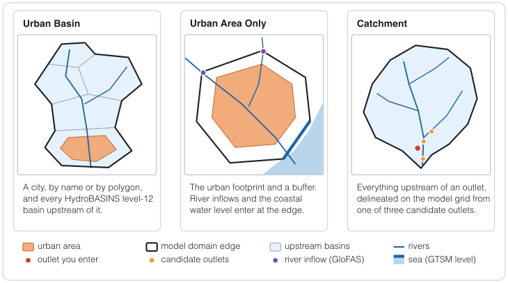
Figure 1. The three kinds of model area, as schematic maps. The thick black line is the edge of the model domain.
| Tab | Domain | Use it for |
|---|---|---|
| Urban Basin | the city and every HydroBASINS level-12 basin upstream of it | urban floods where the water from upstream matters |
| Urban Area Only | the urban footprint and a buffer around it | the city alone, with river inflows and coastal water levels at its edge |
| Catchment | everything upstream of an outlet you choose | a river basin, with or without a city |
Urban Basin
Location input offers City name or Polygon file.
- City name: type the City and the Country. The Builder looks the city up in the GHSL Urban Centre Database R2024A.
- Polygon file: the path of your own urban polygon in Urban polygon path (a GeoPackage, Shapefile or any other vector file GeoPandas can read). Use it when GHSL does not list the city or when you need another boundary.
The Builder intersects the city with the HydroBASINS level-12 basins and follows their upstream links. The domain is the city and all those upstream basins. HydroBASINS level 12 is the finest global level, but it remains a regional outline. FABDEM and HydroBathyDEM give the terrain and the routing inside it.
The two urban tabs offer two grid types: a Uniform grid or a Quadtree grid that keeps the city fine and the rest coarse (Case settings).
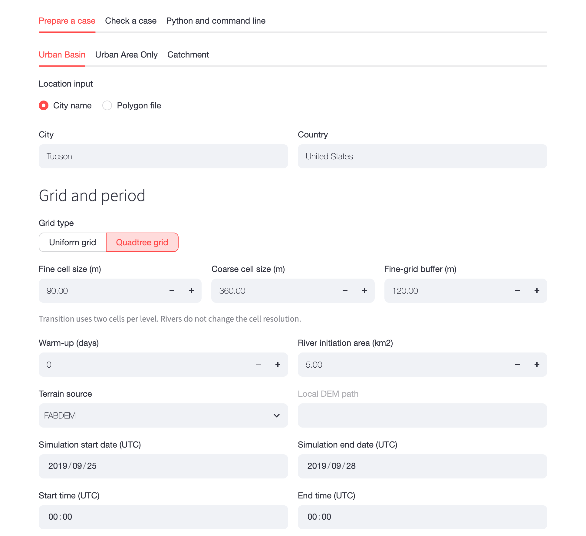
Figure 2. The Urban Basin tab for Tucson, Arizona, with a quadtree grid of 90 m cells over the city and 360 m cells over the rest of the basin.
Urban Area Only
The location input is the same as in Urban Basin. The domain is the connected urban footprint and an Exterior buffer around it (1 km by default), without the upstream basins.
Every outer edge of the domain gets one boundary condition. Critical flow is the default. Where they apply, GloFAS river inflows and a Coastal water level from GTSM replace it, in this order of priority: tide, then GloFAS inflow, then critical flow. The settings are in Urban boundary conditions.
The preview lists the Rivers entering the domain: the HydroRIVERS crossings of the domain edge, on a map and in a table. In the table you can untick accepted for a crossing or move it with its longitude and latitude. Save river-entry review saves your choices, and Prepare complete case uses them.
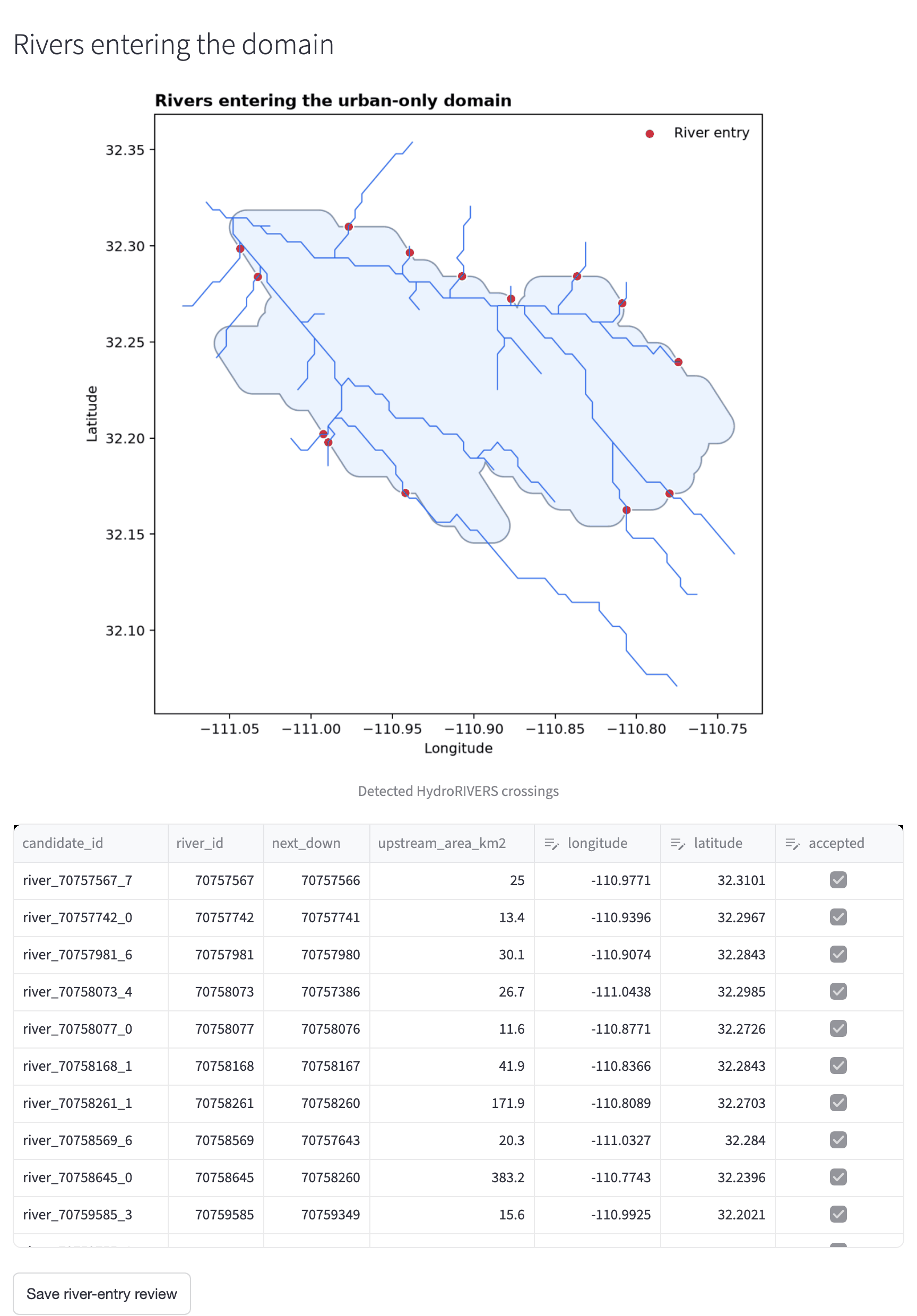
Figure 3. Rivers entering the Tucson urban-only domain, after the preview. Each red point is a place where a river crosses the domain edge. The table lists them with their upstream area.
Urban Area Only cases run on the native mesh solver of HydroPol2D (UGRID), for both grid types.
Catchment
Give the case a Catchment name, then choose the Outlet input:
| Outlet input | What you give |
|---|---|
| Map click | click the outlet on a topographic map. The page shows the clicked latitude and longitude. |
| Coordinates | Longitude and Latitude in degrees (WGS 84). |
| Point file | a vector file with one point. |
| Polygon file | a polygon, used either exact (as the catchment) or as a search area (Polygon use). |
Three more settings place the outlet on the river network:
- Snap radius (km, 0 = automatic): how far the outlet may move to reach the river. Automatic is the larger of 1 km and two model cells.
- Outlet candidate: the preview finds the three strongest nearby outlet cells on the HydroSHEDS flow accumulation. Choose 1, 2 or 3. Changing it updates the preview by itself.
- Critical outlet cells: the number of connected boundary cells at the outlet that get a critical-depth condition (10 by default).
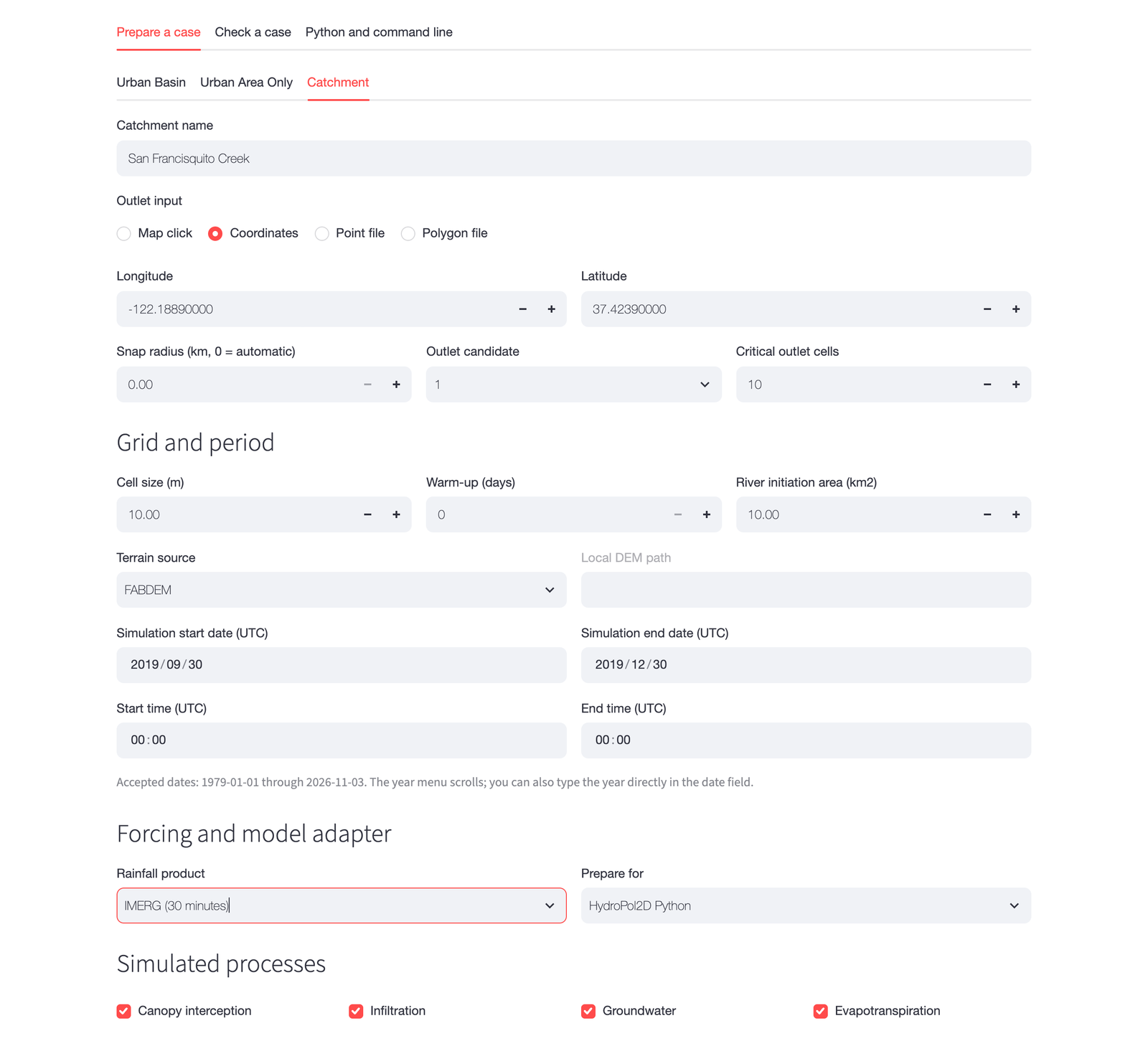
Figure 4. The Catchment tab for San Francisquito Creek at Stanford, California, with the outlet given by its coordinates and a 10 m grid.
The preview draws a first outline of the catchment from HydroSHEDS. The complete build then fills the depressions of the terrain at the model resolution, computes D8 flow directions, snaps the outlet again and traces every cell upstream. The final catchment and the first outline are both kept. If their areas differ by more than a factor of two, the case does not pass the check until you review it (try another candidate or a larger snap radius).
Catchment cases use a uniform grid. They are the only cases with the deep-aquifer baseflow and the groundwater calibration from observed streamflow (Case settings).