
Developed Models
Open-source hydrologic, hydraulic, and stormwater tools
Selected models and code from my research workflow
These tools connect numerical modeling, green infrastructure design, flood routing, digital twins, and decision support. Most are research codes developed around published studies, teaching material, or ongoing collaborations.
Distributed hydrology and hydraulics
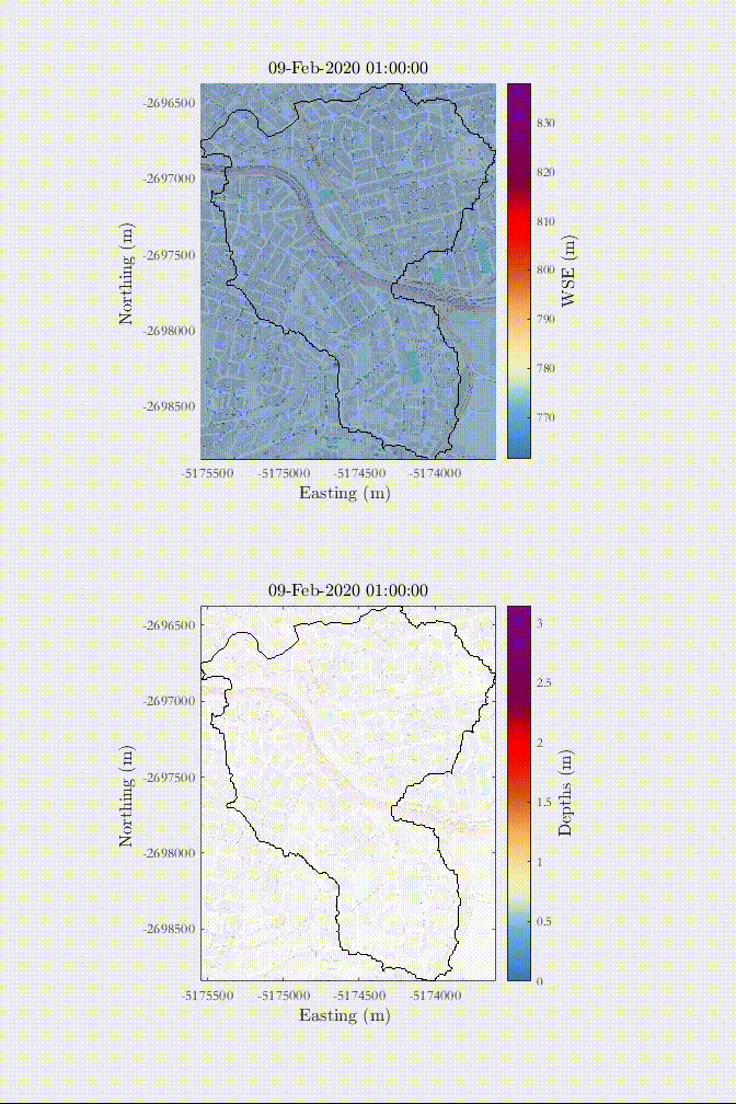
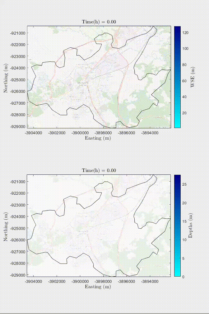
HydroPol2D
HydroPol2D is a fully distributed hydrologic-hydrodynamic model for flood-related simulations, water-quality routing, dam-break scenarios, rain-on-the-grid events, and urban drainage applications.
- Raster-based terrain, land-use, and soil inputs
- Rain-on-the-grid, hydrograph, stage, dam-break, and control boundary conditions
- Green-Ampt infiltration, Penman-Monteith evapotranspiration, groundwater exchange, calibration, and sensitivity analysis
Full-momentum 1D hydraulics
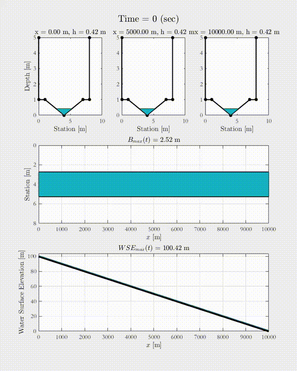
HydroHP-1D
HydroHP-1D solves the one-dimensional full momentum de Saint-Venant equations for multiple channel shapes and boundary-condition combinations.
- Rectangular, triangular, trapezoidal, parabolic, circular, irregular, and composite cross-sections
- Flexible Manning roughness conceptualizations
- Inflow, Nash, tidal outlet, stage hydrographs, and combined boundary conditions
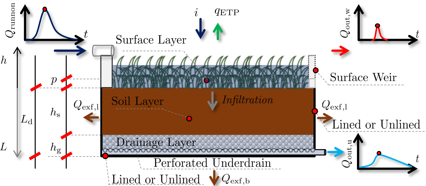
Infiltration-based LID modeling
DRAIN-LID
DRAIN-LID is a mixed-form Richards equation solver for one-dimensional saturated and unsaturated flow in low-impact development systems, designed for continuous high-resolution simulations over long periods.
Rainfall extremes and IDF curves
GRIDF-BR
GRIDF-BR is a set of Python and MATLAB tools for processing rasterized rainfall products, extracting extremes, bias-correcting satellite datasets, and computing intensity-duration-frequency curves for Brazil.
DEM conditioning and bathymetry preparation
HydroBathyDEM
HydroBathyDEM is a Python toolbox for adapting existing digital elevation models into hydrologic-hydrodynamic conditioned DEMs. It supports workflows where terrain data need to be prepared for flood, river, and surface-flow modeling applications.
- Hydrologic-hydrodynamic DEM conditioning workflow
- River-aware terrain and bathymetry preparation
- Python-based tooling for preprocessing model-ready elevation data
Control-oriented stormwater modeling
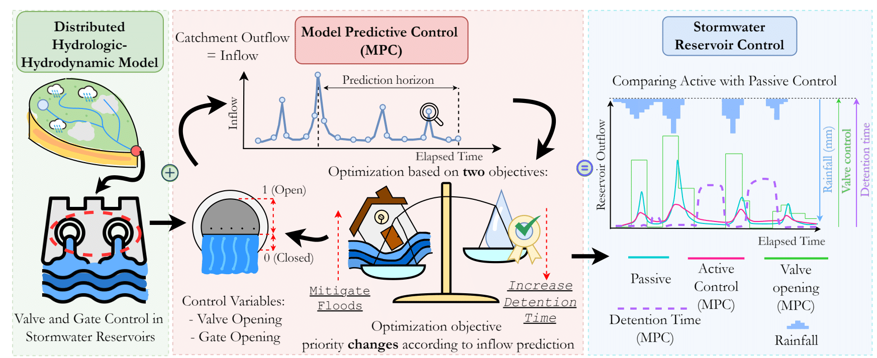
RTC-Stormwater
RTC-Stormwater linearizes hydrologic and hydrodynamic equations for catchments, reservoirs, and channels, providing a state-space modeling framework for reactive and predictive control algorithms.
- Kinematic and diffusive-wave routing components
- Model predictive control, linear quadratic regulators, and linear quadratic integrators
- Reservoir mass and energy conservation equations
Bioretention analysis and design
TC-Hydro
TC-Hydro supports bioretention design, routing, sensitivity analysis, calibration, Monte Carlo simulation, and cost-aware design optimization using Excel-VBA and MATLAB implementations.
Lot-scale LID reservoir design
LotScaleReservoir
LotScaleReservoir contains the software developed for the study on accounting for spatial runoff variability in LID design for urban catchments. The tool supports lot-scale reservoir and low-impact development design where runoff contribution varies across urban parcels.
- Catchment-aware lot-scale reservoir sizing
- Software companion to the spatial runoff variability LID design paper
- Design workflow for urban catchment mitigation and adaptation studies
Detention pond design
MODOBR
MODOBR is an Excel-VBA retention pond design algorithm focused on hydrologic routing, maximum ponding depth, and clogged-device design conditions.
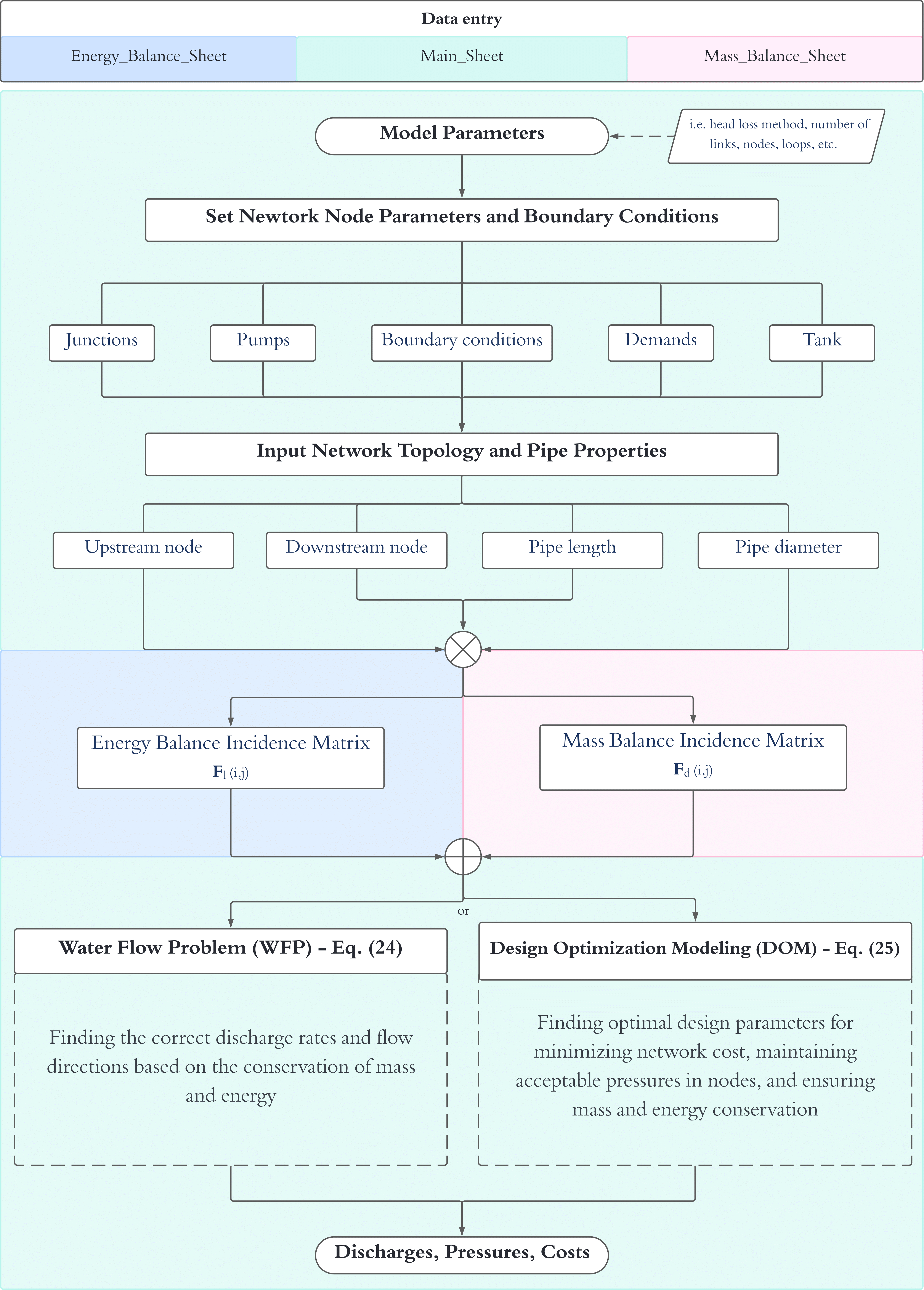
Hydraulic networks and structural sizing
X-WHAT
X-WHAT solves hydraulic network flow while optimizing tanks using pipeline, reservoir, and foundation costs with lateral wind stress assumptions.
Numerical shallow-water equations
SWE-Solver
A simple, well-balanced, conservative shallow-water equations solver for visualizing two-dimensional fluid dynamics problems using a four-point explicit numerical scheme.
Hillslope-storage Boussinesq modeling
1D hsB Model
A finite-volume implementation of a one-dimensional Hillslope-Storage-Boussinesq model for saturated flow in porous media under hillslope-width controls.
Coupled surface-subsurface hillslope modeling
Coupled hsB-SM Model
The hsB-SM model links atmosphere, soil water, groundwater, lateral baseflow, and routed surface runoff in a parsimonious hillslope framework. This tool is currently under development.